

cross-posted from: https://lemmy.world/post/1815113
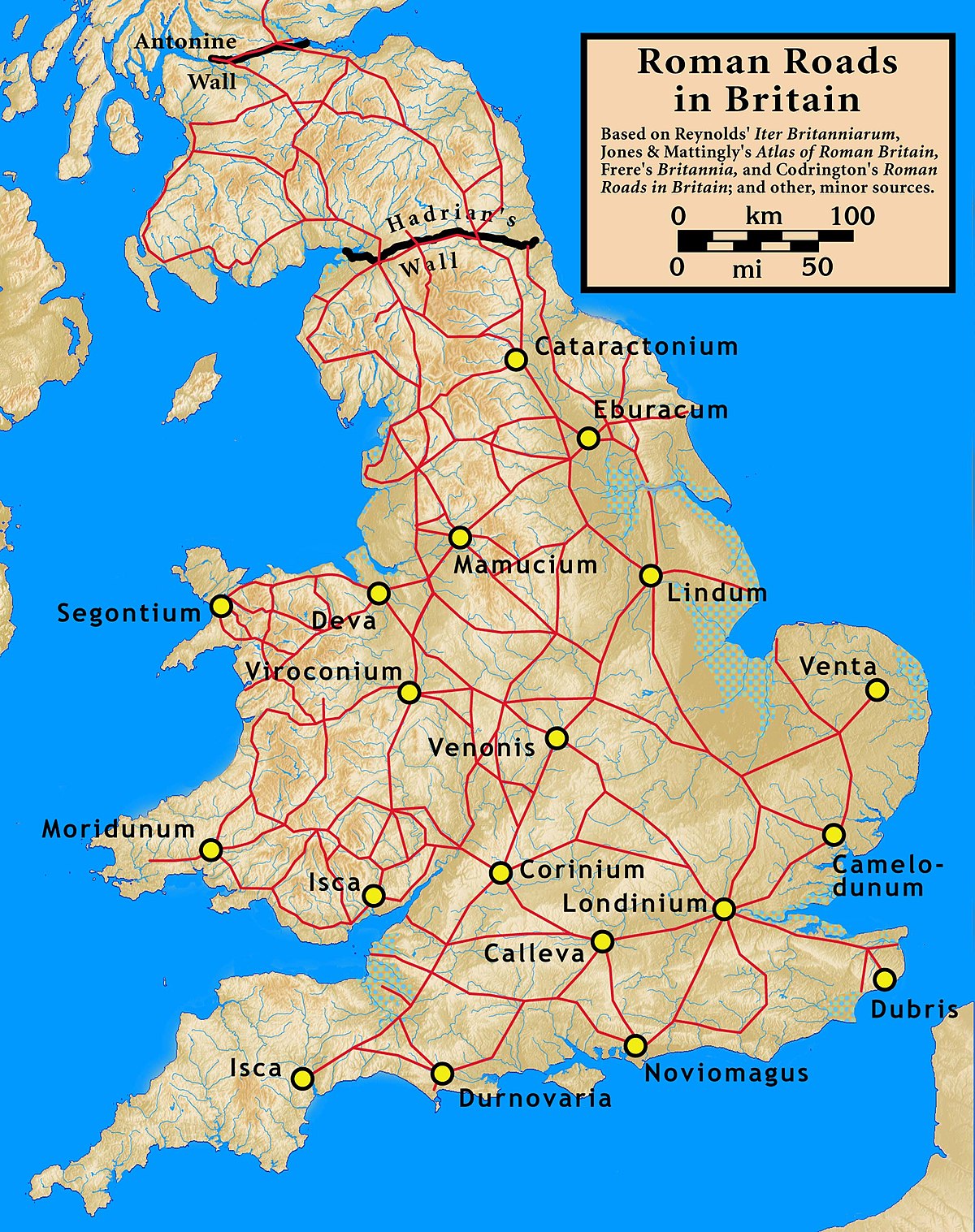
After the Romans departed, systematic construction of paved highways in the United Kingdom did not resume until the early 18th century. The Roman road network remained the only nationally managed highway system within Britain until the establishment of the Ministry of Transport in the early 20th century.
You must log in or register to comment.
I think systematic is the thing there, like paved roads were being built, but nobody was looking at the map and deciding the most efficient place for a new road, they’d just want a road so they did one. A lot of British roads go in a straight line from random places, so you end up with odd layouts where for example, all the roads in a town are spokes from the church, because in that town the church was deciding roads.
Then of course that village becomes a city and you can’t widen these random roads that all the buildings are on, so they now have giant traffic jams if you choose to go to the centre.
If you look at the crooked Warren of spaghetti that is the London street map, one road stands out for its straightness: Edgware Road (known in my area as Shoot-Up Hill). Wouldn’t you know it, it’s the Roman road.
https://en.wikipedia.org/wiki/Edgware_Road
Edgware Road is a major road in London, England. The route originated as part of Roman Watling Street and, unusually in London, it runs for 10 miles in an almost perfectly straight line.